As I’ve mentioned in previous posts, Wyoming is a headwater state. Straddling the continental divide, Wyoming feeds four major river basins: the Missouri-Mississippi, Green-Colorado, Snake-Columbia, and Great Salt Lake.1
Given the low rainfall in Wyoming’s lower elevations, we all keep a close eye on the mountain snowpack. The mountain snowpack will, for the most part, determine the amount of water filling our streams and rivers. The weather will determine how fast that snow melts and whether we enjoy a long season of plentiful water, or a short and potentially destructive season of high stream flows.
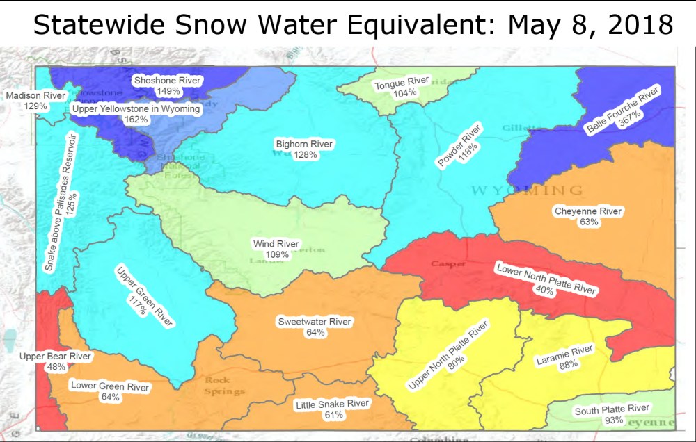
A series of SNOTELS are stationed around the state and continuously measure the snowpack at high elevations, but the depth of the snow is only part of the story. It’s not unusual for Wyoming to get a very dry kind of snow, so the “snow water equivalent” gives us the best idea about how much water will be coming down out of the mountains. As with most things weather related, there is high variability in the snow water equivalent across the state. Regardless, we are praying the snow comes off nice and slow.
